Land measurement is a fundamental aspect of rural project development, influencing everything from zoning regulations to agricultural productivity. Understanding the intricacies of land measurement can significantly enhance the efficacy of rural projects. As urbanization expands outward, the ability to accurately assess land becomes essential for developers, farmers, and local governments alike.
Exploring the Need for Accurate Land Measurements
Accurate land measurement is indispensable for various stakeholders involved in rural development. This section delves into its significance across different sectors.
Impact on Agricultural Efficiency
Farmers rely heavily on precise acreage assessments for a multitude of reasons. Accurate soil measurement informs crop planning, ensures effective irrigation strategies, and helps optimize resource allocation. This directly affects yield and profitability, making land measurement a linchpin in agricultural practices.
Real Estate Development and Planning
In the realm of real estate, precise mapping and measurement are crucial. Developers must ensure that all plotted designs adhere to zoning regulations and property boundaries. Miscalculations can lead to regulatory issues or disputes with neighboring properties, jeopardizing the entire project. Therefore, understanding the nuances of boundary definitions is key in avoiding potential legal challenges.
Understanding Land Measurement Units
To effectively navigate measurement tasks, a solid grasp of standard land measurement units is essential. Here, we’ll discuss the most frequently used units and their relevance.
Common Land Measurement Units
In various contexts, the following units of measurement are commonly employed:
- Acre: Equivalent to 43,560 square feet
- Hectare: A metric unit measuring 10,000 square meters, widely used internationally.
- Square Foot: Used for smaller residential properties, equivalent to 0.092903 square meters.
Understanding how these units interrelate is vital for seamless project execution. For instance, converting acres to square feet is often required during planning stages.
Embracing Modern Measurement Techniques
As technology continues to advance, the methods used for land measurement have evolved significantly. Utilizing modern tools enhances accuracy and efficiency.
The Role of Geographic Information Systems (GIS)
Geographic Information Systems (GIS) revolutionize land measurements by integrating geospatial data. GIS tools can map and analyze terrain features effectively. Such systems allow users to visualize landscapes, making it easier to assess land use potential.
Employing Drones for Aerial Surveys
Drones have transformed land measurement practices, allowing for comprehensive topographical surveys. They capture aerial images that their processing can convert into detailed 3D maps, providing insights into topography and land features. This technology is particularly beneficial for large plots, making complex measurements accessible.
Challenges in Accurate Land Measurement
Despite modern tools, challenges remain in the domain of land measurement. Understanding these obstacles is vital for successful rural project planning.
Terrain Variability
Uneven terrain can complicate the measurement process. Natural features, such as hills or valleys, introduce variables that may distort measurement efforts. Thus, employing advanced surveying techniques becomes necessary to maintain accuracy.
Legal Discrepancies in Boundaries
Often, legal definitions of boundaries conflict with their physical representations. Differences in land surveys can create disputes necessitating clear communication and documentation across all parties involved.
How to Measure Land Effectively
For those venturing into DIY land measurement, several techniques can ensure accurate results. Utilizing the right tools is paramount for success.
Essential Tools for DIY Measurement
Here are a few key tools that can facilitate effective land measurement:
- Measuring Tape: Ideal for short distances and straightforward measurements, best for defining standard boundaries.
- GPS Devices: Useful for establishing coordinates and calculating distances with high precision.
- Digital Apps: With smartphone applications designed for land measurement, users can easily calculate area and dimensions.
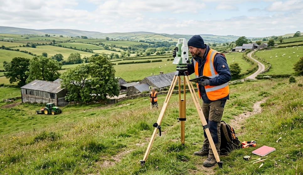
Benefits of Consulting a Professional Surveyor
While self-measurement is feasible, engaging a professional surveyor can mitigate errors significantly, especially in complex situations. Their expertise can yield accurate assessments, crucial for legal transactions and developments.
When Professional Help is Advisory
In matters pertaining to legal disputes or construction projects, hiring a qualified surveyor is advisable. Surveyors possess the necessary tools and knowledge to navigate challenges that may arise, ensuring all measurements comply with relevant laws and standards.
In summary, understanding the intricacies of land measurement in rural projects extends beyond basic area calculations. It encompasses agriculture, real estate, and the utilization of advanced technologies, all while navigating potential challenges. By employing accurate methods and seeking professional guidance, rural development projects can avoid pitfalls while maximizing land use efficiency.