In today’s fast-paced world, drone mapping has emerged as a game-changing technology across various industries. From agriculture to construction, these unmanned aerial vehicles offer innovative solutions that enhance efficiency, safety, and decision-making processes. Join us as we explore the diverse applications and transformative impact that drone mapping is having in modern industries.
Drone Mapping in Agriculture
One of the most prominent applications of drone mapping is in the agricultural sector. Farmers are increasingly turning to precision agriculture to optimize yield and resource management. Here are some ways drones are utilized:
- Crop Monitoring: Regular aerial surveys facilitate continuous monitoring of crop health. Drones equipped with multispectral cameras can detect variations in plant vitality, enabling farmers to address issues before they escalate.
- Soil Analysis: Detailed maps generated from drone data can reveal soil quality, moisture levels, and nutrient content, allowing for targeted interventions.
- Precision Spraying: Drones can administer fertilizers and pesticides accurately, reducing waste and minimizing environmental impact.
Construction Industry Transformation
The construction sector is another industry reaping the benefits of drone mapping. By harnessing drone technology, construction managers can enhance project oversight and streamlining workflows:
- Site Surveying: Drones provide rapid and accurate surveying capabilities, producing precise 3D site models that streamline planning and execution.
- Progress Monitoring: Real-time mapping helps monitor construction progress against timelines, allowing managers to identify delays early and make timely adjustments.
- Safety Inspections: Using drones for safety inspections mitigates risk. Drones can access high or hazardous areas without requiring personnel to enter risky environments.
Enhancing Environmental Monitoring
Drone mapping plays a crucial role in environmental monitoring, providing valuable insights into ecological changes and health:
- Biodiversity Assessment: Drones can gather data in hard-to-reach ecosystems, helping researchers monitor wildlife populations and habitat changes without disturbing them.
- Pollution Tracking: With the ability to cover large areas, drones can identify pollution hotspots in air or water quality, aiding regulatory compliance.
- Climate Change Research: By capturing geospatial data over time, drones assist scientists in studying the impacts of climate change on landscapes and ecosystems.
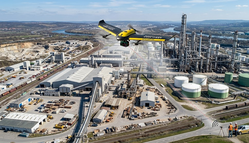
The Mining Industry’s New Frontier
Drones are revolutionizing the mining industry as well, providing innovative solutions for exploration and monitoring:
- Site Mapping: Drones create accurate 3D models of mining sites, aiding in planning and operational optimization.
- Volumetric Analysis: Accurate volumetric calculations for stockpiles can be quickly obtained, improving inventory management.
- Environmental Compliance: Drones help monitor adherence to environmental regulations by documenting site changes and assessing potential impacts.
Energy Sector Advancements
The energy sector benefits significantly from drone mapping, especially in the maintenance and inspection of infrastructure:
- Asset Inspection: Drones equipped with thermal imaging can quickly identify faults in power lines, solar panels, and wind turbines, facilitating preventative maintenance.
- Pipeline Monitoring: Drones ensure the integrity of pipelines across extensive areas, providing quick assessments and detecting leaks effectively.
Telecommunications Efficiency
In telecommunications, drone mapping optimizes operations and accelerates infrastructure development:
- Tower Inspections: Drones conduct fast and safe inspections of communication towers, allowing for the assessment of structural integrity without risking worker safety.
- Network Planning: Aerial surveys assist companies in evaluating potential sites for new towers, optimizing coverage and minimizing service disruption.
Future Trends and Innovations in Drone Mapping
As technology continues to evolve, the potential for drone mapping expands. Future trends include:
- AI Integration: AI algorithms are enhancing the speed and accuracy of data analysis, enabling real-time insights and predictive analytics that can preempt issues.
- Cloud Computing: Cloud platforms enhance collaboration by allowing teams to access and analyze data from anywhere, streamlining decision-making processes.
- Multi-Sensor Drones: Future drones will likely integrate various sensors to provide more comprehensive data collection in a single flight, increasing the efficiency and scope of mapping projects.
In summary, the integration of drone mapping technology across various industries is transforming how we gather and analyze data, leading to enhanced efficiency and decision-making. For specialized needs, consider collaborating with drone mapping experts to maximize the benefits of this innovative tool in your operations.